
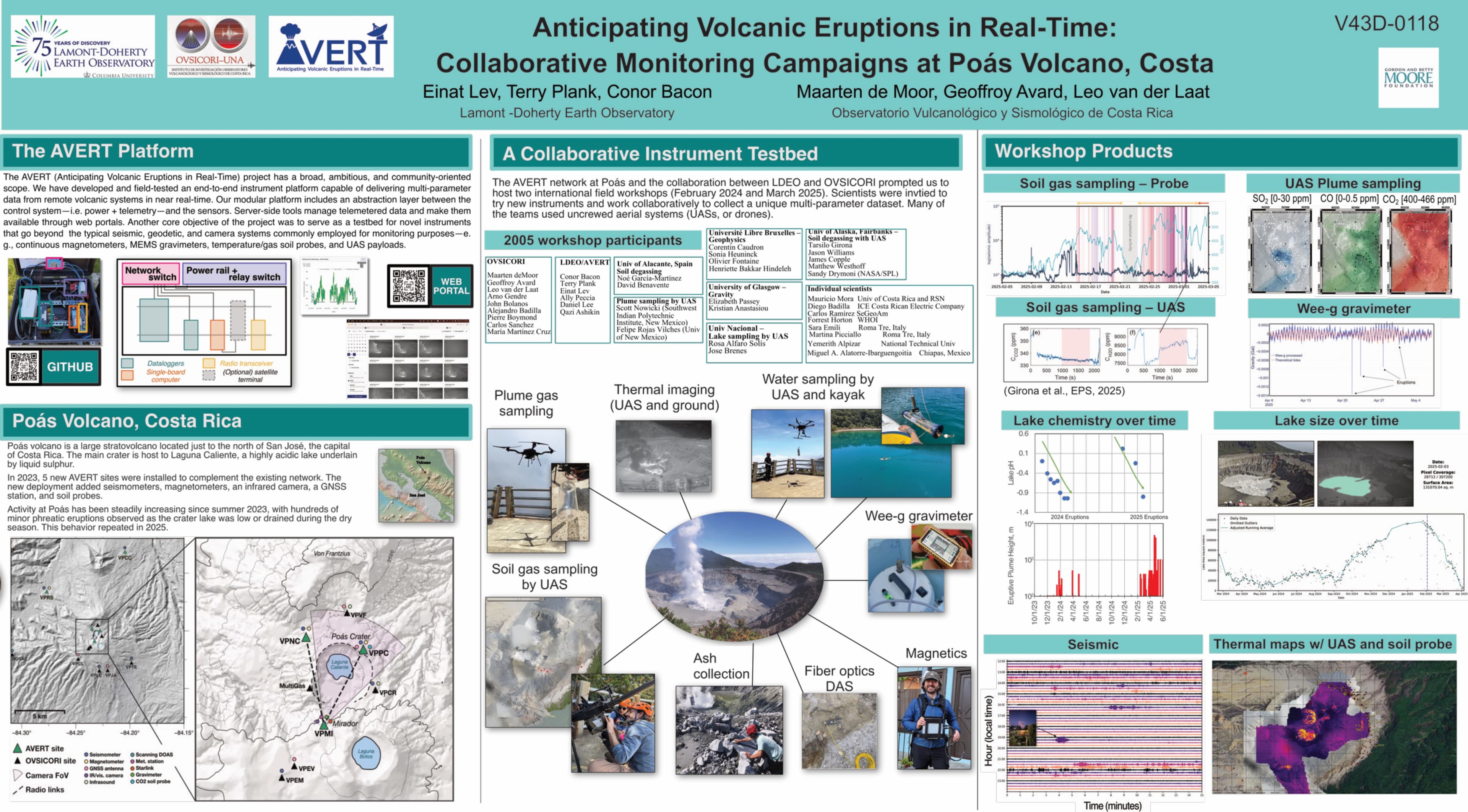
POÁS
COSTA RICA
10.20000° N, 84.23300° W
OVERVIEW
Poás is a large stratovolcano located in the Cordillera Volcanica Central, Costa Rica
The broad vegetated edifice of Poás, one of the most active volcanoes of Costa Rica, contains three craters along a N-S line. The frequently visited multi-hued summit crater lakes of the basaltic-to-dacitic volcano are easily accessible by vehicle from the nearby capital city of San José. A N-S-trending fissure cutting the complex stratovolcano extends to the lower N flank, where it has produced the Congo stratovolcano and several lake-filled maars. The southernmost of the two summit crater lakes, Botos, last erupted about 7,500 years ago. The more prominent geothermally heated northern lake, Laguna Caliente, is one of the world's most acidic natural lakes, with a pH of near zero. It has been the site of frequent phreatic and phreatomagmatic eruptions since an eruption was reported in 1828. Eruptions often include geyser-like ejections of crater-lake water. Description from the Global Volcanism Program website.
NETWORK HISTORY
Poás's network before and after AVERT
Compare how monitoring sites, instruments, and telemetry links have changed across different phases of deployment

RECOMMENDED FOR YOU
Related reading
AVERT presentation at AGU 2025 Fall Meeting
SITES AND INSTRUMENTS
Volcán Poás Crater
Environmental: Soil CO2
- Soil CO2 data available through AVERT monitoring systems
- Part of comprehensive volcanic monitoring network
- Data used for gas emission studies
