Report on the Second Poás Volcano Field Workshop
For a week in March, 2025, a group of ~40 scientists and students came together to experiment with novel instrumentation on Poás Volcano in Costa Rica. This field workshop followed from a very successful one in 2024, which motivated the call for participation in 2025. Individuals from 6 countries responded to an open advertisement, with a final group of 25 joined by 16 scientists from different Costa Rican organizations. Once again, the workshop was organized jointly by the AVERT project and OVSICORI (Observatorio Vulcanológico y Sismológico de Costa Rica).
Poás had been highly active since January 2025, erupting plumes of steam and mud up to 300 m high in phreatic and phreatomagmatic explosions. The day the participants arrived (Sunday, March 9), the volcano had one of its largest eruptions in 2025 (Fig. 1), depositing ash on the crater rim and on the southern flank of the von Frantzius cone. This led to closing of the Poás National Park on Monday, March 10, although workshop participants were granted access to the Poás Mirador, crater rim, and environs throughout the week thanks to close communication between Park leadership and OVSICORI scientists. The park subsequently opened on Tuesday, March 11, and remained open to visitors throughout the week, despite another eruption on the evening of March 13 (Thursday). Safety was of utmost concern, and workshop participants met each morning in the Visitors' parking lot to hear of the latest seismic, geodetic, and gas observations in order to develop informed and safe plans for the day. On several days, the number of participants was limited to small teams working on the crater rim. Access to the crater proper was not permitted for the entire week. Some groups worked at the Mirador or more remote environs.
Poás eruption on March 9, from Hotel Altura, where participants were meeting as a group for the first time to discuss the week’s goals. Photo: Einat Lev
Participants met each other and shared their motivations and goals in a kick-off meeting on Sunday, March 9, at Hotel Altura (Figure 2). This was an opportunity to see the full scope of work planned and to form groups that would collaborate throughout the week. Each subsequent evening, participants gathered before dinner at El Churrasco or Lo Que Te Quieras restaurants to debrief on the events of the day, share successes and challenges, and plan for the next day’s “wish list.” Over the course of the week, every participant collected data in accord with their instrumentation goals. Below is a brief summary of each teams’ accomplishments during the workshop and plans for the future.
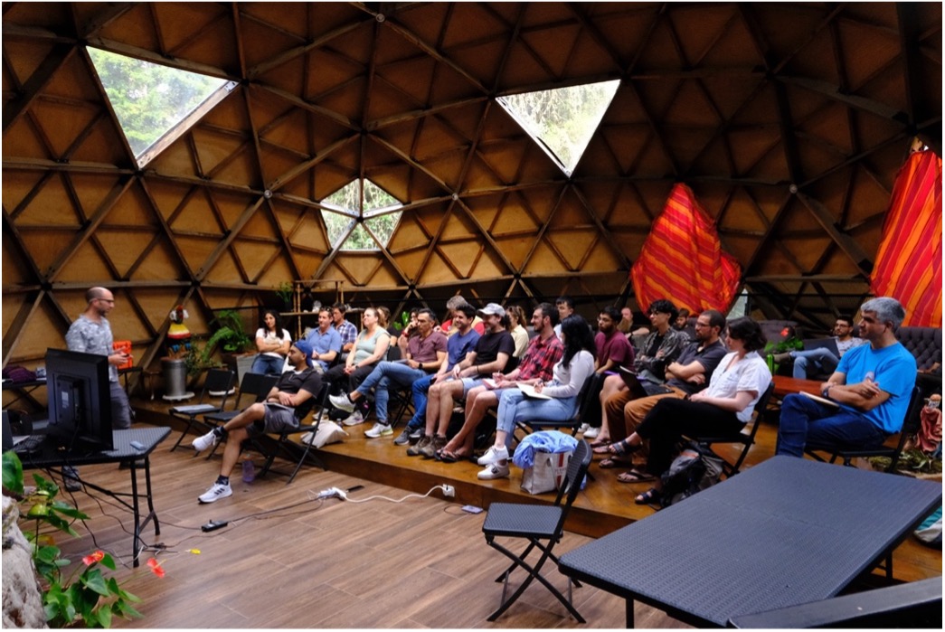
The workshop kick-off meeting. Photo: Conor Bacon
CO2 Soil Degassing. A large team, led by the University of Alaska's Geophysical Institute Research Scientist Társilo Girona, aimed to measure CO2 degassing from soil in and around Poás crater using a custom-built Remotely Piloted Aircraft System (i.e., a drone). Three pilots, Jason Williams, James Copple and Matthew Westhoff, also from the GI, commanded the aircraft in a complex operation that involved a fleet of drones flying together, one to measure soil gas and the other two to aid in landing. Kyriaki Drymoni from Ludwig-Maximilians-Universität in Munich and the Jet Propulsion Lab and Girona oversaw operation of the remote measurements of soil CO2, H2O and temperature. After some delays due to technical issues and weather, the drone successfully landed, took measurements and returned from a reference site on the crater rim, and three sites on the crater floor.
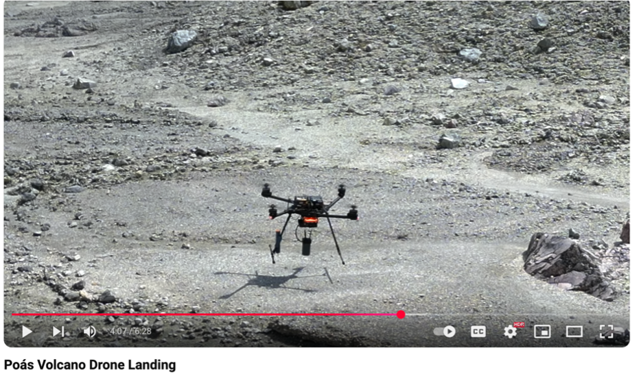
Screenshot from the drone landing video shows the RPAS landing on the Poás crater floor.
In order to complement the drone-based measurements, a team carried out walking surveys of soil degassing all week: David Benavente and Noé García-Martínez of the University of Alicante, Spain and Sara Emili and Martina Picciallo of Roma Tre University, Italy. Girona and Drymoni also assisted in the surveys, with help from other workshop participants. The primary data collected were soil CO2 flux measurements, using an instrument comparable to the drone payload. Measurements were also made of H2O soil flux as well as radon and temperature. Samples of air and soil were also collected for future C and H isotopic analyses. A transect was carried out, covering almost half the circumference of the crater rim centered about the NE sector. Additional transects were made around Lago Botos and also on the Eastern Terrace below the crater rim. CO2 soil fluxes were measured at a total of 283 locations. High CO2 anomalies were found on the Eastern Terrace (which is bounded by an active fumarole bank), two-to-three orders of magnitude larger than in other locations.
Girona (foreground) and Drymoni (background) inspect the drone pre-flight.
A paper has already been submitted to describe the prototype drone-based system and to compare to the ground-based measurements of CO2 traverses. Isotopic analysis will be crucial to determine the extent to which these gases are magmatic in origin. The Alaska group also produced a video of the Poás Volcano Drone Landing:https://youtu.be/9A0efL5KBI0
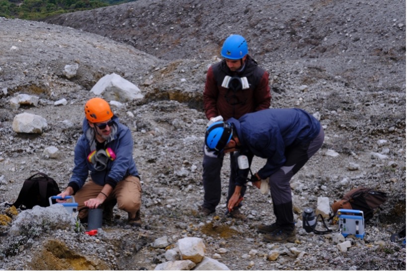
From left to right, Girona, Garcia-Martinez, and Benavente run ground-based sampling of soil CO2 degassing. Photo: Conor Bacon
Fiber Optic Cable. Over the course of the week, Corentin Caudron, Sonia Heuninck, Olivier Fontaine and Henriette Bakkar Hindeleh from Université Libre Bruxelles, Belgium, installed a fiber Bragg grating interrogator (FBG) along the eastern sector of the crater rim. The FBG and router are powered by two Lithium batteries, a solar controller and two solar panels for continuous monitoring, with a sampling rate of 1 Hz. All the fibers were buried in the ground along with sensors to measure temperature (2 lines), tilt (2 sensors), strain (9 sensors), and acceleration (2 sensors). One of the temperature lines was deployed down the crater rim onto the east terrace to monitor the low temperature (~100 °C) fumarole bank.
Deployment of the FBG on the crater rim. Photo: ULB
The cabled observatory was left on Poás after the workshop to assist in monitoring and to provide a time-series for research. The system was configured for telemetry, but challenges with establishing a connection has meant that, for now, data are recorded onsite and require personnel to download. The objective is to leave the monitoring setup for as long as possible.

Tilt sensors (~30 cm in length) in the proximity of the east terrace of Poás. Photo: ULB
Spring and Lake Sampling. There were two primary efforts for these teams: Sampling natural springs on the flank of Poás, and sampling the crater lakes of Poás and Botos.
Routes followed during spring exploration and sampling. On the left, the north fork of Rio Agrio was approached from the base of the Poás. On the right, the spring on the south fork of Rio Agrio was accessed from the Mirador at the summit of Poás.
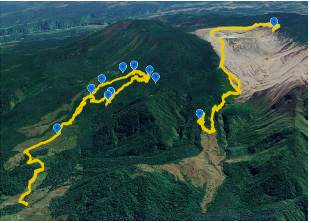
The primary objective of the spring sampling was to identify sites for future geochemical monitoring of dissolved volcanic gases, in particular, the noble gases which have elsewhere been linked to magma ascent and other precursory signals. The spring sampling efforts throughout the week were exceptionally challenging, and involved many in the science party (Maarten de Moor, Alejandro Rodrigues Badilla and Carlos “Kly” Sanchez of OVSICORI; Corentin Caudron and Olivier Fontaine of the Univ. of Bruxelles; Scott Nowicki of the SW Indian Polytechnic Institute; and David Benavente and Noe Garcia of the Univ. of Alicante), led by Forrest Horton of Woods Hole Oceanographic Institution, US, and Ally Peccia of LDEO. Targets were chosen in the Rio Agrio drainage basin on the NW flank of Poás. The springs along the north fork of the Rio Agrio were attempted three days in a row (March 10-12) by hiking from the termination of Calle El Hoyo through cow pastures and jungle, with no success due to impassable cliffs and ravines. The group concluded that access to these springs probably requires a technical ascent along the river with the assistance of local guides. On March 13, the group descended from Poás crater into the southern fork of the Rio Agrio and found steam rising from the ground and water discharging out of one primary and one secondary spring. Water samples were taken via copper tubing and in bottles, and a CTD (conductivity, temperature and depth) probe was provided by the Univ of Bruxelles for later installation by OVSICORI staff to enable continuous measurements every 15 minutes.
Brenes setting up the long-term aerosol sensor at the park headquarters. Photo: Yemerith Alpízar
Samples will be analyzed for noble gases and other analytes, and the CTD timeseries will provide insights into the dynamics of the lower part of the hydrothermal system. This reconnaissance work paves the way for future autonomous samplers such as the mini-REUDI and SPARTA in and around the Río Agrio Spring for long term monitoring and timeseries of noble gases.
Another effort involved collecting water samples from Poás Crater (by drone) and Botos Crater (by kayak). This team was led by Jose Brenes and Rosa Alfaro Solís (of UNA) and Yemerith Alpízar (of the National Technical University of Costa Rica). Jose and Rosa also later in the week installed an aerosol sensor at the Poás National Park Visitor Center. Water samples will be measured for major ions and isotope compositions (at UNM) and compared to the long time-series being developed by these investigators over the past years of volcanic activity at Poás.
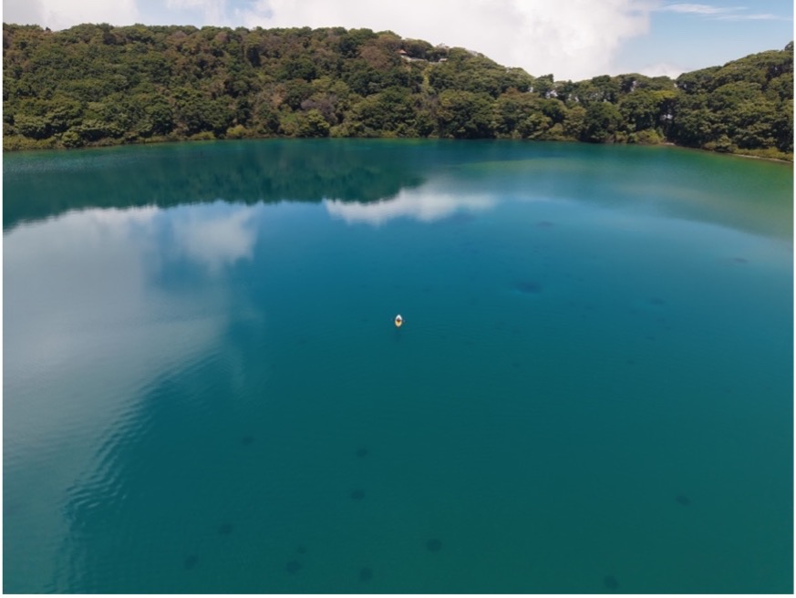
Drone shot of Lago Botos showing a kayak (center) performing water sampling. Photo: Yemerith Alpízar
Drone-Sampling of Gas Plume. The goal of this work was two-fold. The first involved the use of drones that incorporate a new remotely activated pump and valve system that would capture gas samples in the plume for further analysis in the lab. The second is the testing of desiccants to capture water vapor from volcanic plumes that could give insight into the water vapor composition of the gas emissions and the origin of the fluids coming from the volcano. With both techniques, the idea was to activate the system once the drone was inside the plume. Felipe Rojas and Scott Nowicki of the Univ of New Mexico led this effort, with help from Qazi Ashikin, Daniel Lee, and Einat Lev of LDEO. A DEM and orthomosaic were initially created in order to spatially locate the plumes and create gas interpolation maps. IR and near-IR images were also created over multiple days (Figure 12). The MultiGas instrument was flown into the plume on March 12 and 14 to map CO2, H2S, SO2, CO and humidity emissions. One preliminary result is the finding that Boca A was emitting gas with high CO2 concentrations, while Boca C gas had higher SO2. On the same dates, a system was flown that measures CO2 and methane together. Six samples with duplicates (12 total) were collected with the remotely activated pump, and will be extracted under vacuum in laboratory conditions for analysis of δD, δ17O, and δ18O.
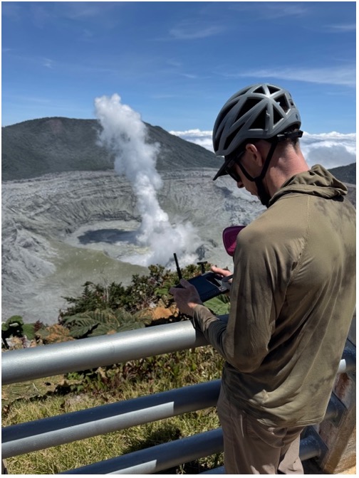
Nowicki piloting a drone from the Mirador. Photo: Einat Lev
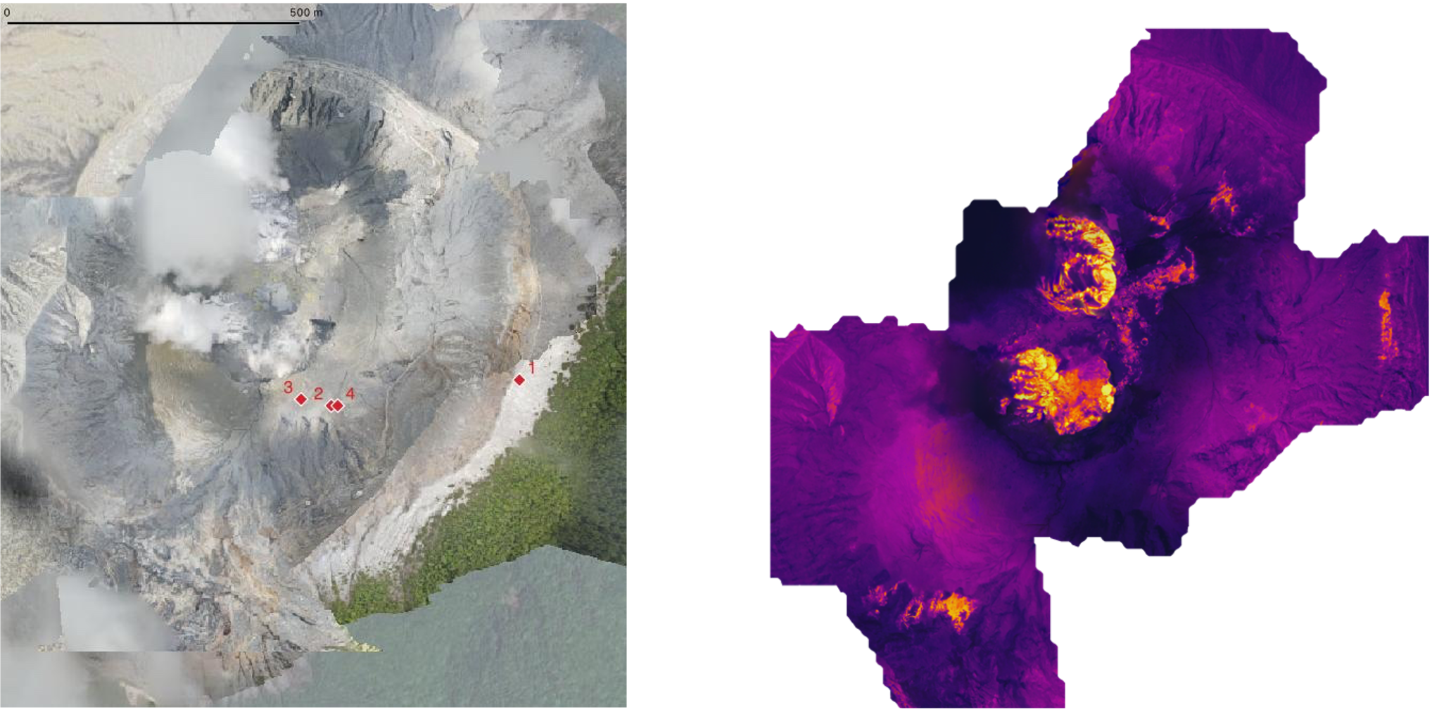
A visible light (left) and thermal infrared (right) orthomosaics of the crater area crated by drone imagery. Red markers on the visible map show the landing sites for the UAF gas ground-sampling drone. In the thermal map, purple shades are relatively cold areas and yellow are hot. The lake and fumaroles are clearly visible. Maps by: Einat Lev
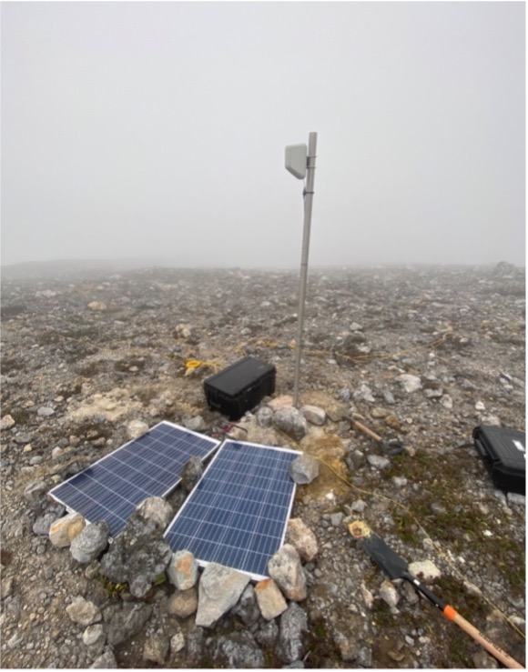
IR Camera Calibrations. There were two efforts focused around calibrating images taken with the IR camera installed on the rangers' hut at the Mirador (VPMI). One involved calibrating IR images in order to calculate the changing surface area of Poás crater lake, using an automated image analysis method developed at LDEO by Qazi Ahikin, Conor Bacon and Einat Lev. The resulting pixel coverage of the lake can now be converted to surface area following measurements made during the field workshop. Geographical coordinate information was obtained by flying drones over the region, which was then used to apply local-scale georeferencing to adjust for camera distortion. A laser range-finder was also used after selecting ground control points to compute the distances from the camera to those points. These corrections have now been applied to develop a timeseries of lake area which shows clear relationships to eruption state.
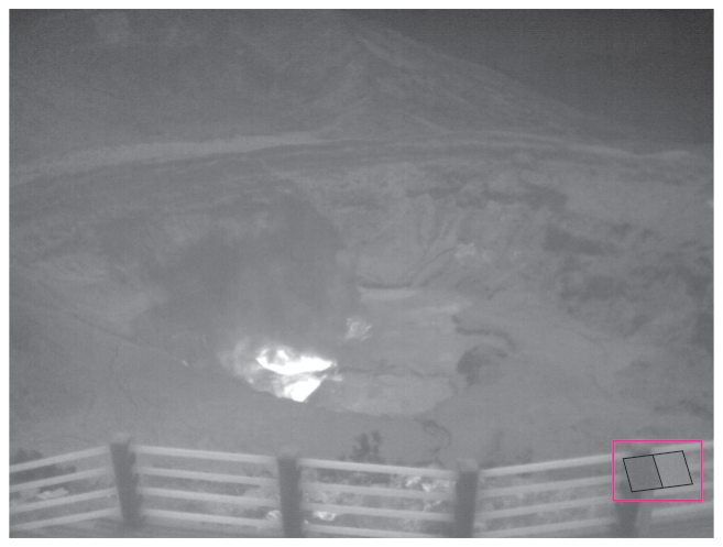
Image from the IR camera, with the new calibration plates highlighted. Image captured May 23, 2025, at 16:49 UTC.
The other effort was to develop a temperature calibration of the IR images. This involved installing small light and dark metal plates on the Mirador roof in the field of view of the IR camera, and then measuring plate temperatures with a thermocouple. A temperature data logger has been built at LDEO and is ready to be deployed in Summer 2025 to provide continuous temperature calibration of the IR images. Conor Bacon, Scott Nowicki, John Bolanos and Einat Lev led this effort.
Wee-g MEMS gravimeter. In February 2024, a Wee-g MEMS gravimeter was installed on Poás volcano and has been taking continuous measurements since. The objective of the installation was to characterize the sensor's performance on an active volcano and send continuous data using the AVERT system. The instrument is located inside the rangers' hut at the Mirador (VPMI), where it receives power and sends data via Starlink to a remote server. One of the key challenges for MEMS-based gravimetry has been the temperature and pressure sensitivity of the sensors.
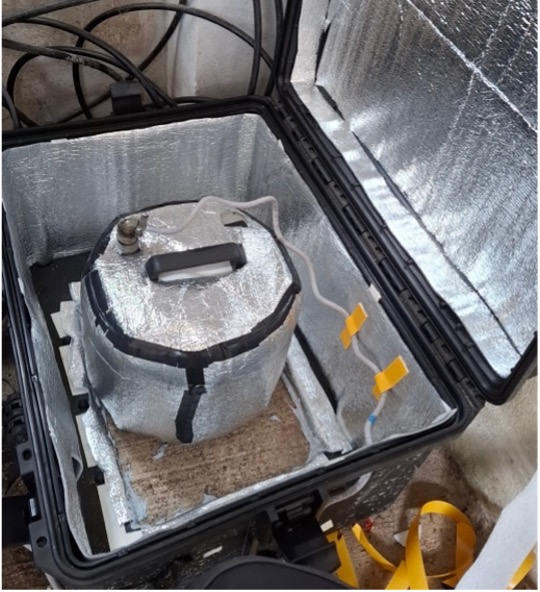
The Wee-g sensor in situ with new thermal insulation. Photo: Elizabeth Passey
Efforts in March 2025 by Kristian Anastasiou and Elizabeth Passey of the University of Glasgow made several improvements to both the sensor and the installation that led to an increase in signal-to-noise of 4.5 and reduction in data loss since the workshop to 0%. Wee-g will be left at Poás, sending data to Glasgow to fully characterize the sensor's temperature and pressure sensitivity and the long-term drift. In the future, the instrument may be replaced with a new prototype currently under development, which could be used in surveys as well as for continuous monitoring.
Gravity Survey. While it is well understood that microgravity measurements are a vital component of imaging volcanic systems, such surveys have not been repeated at Poás since 2004. Working with Grupo ICE, the national energy company in Costa Rica, a new pilot gravity survey was conducted around the Eastern flank of Poás. Grupo ICE provided a LaCoste and Romberg gravity meter (G787) to Libby Passey, in order to take measurement along the crater rim. Over two days, measurements were taken at eleven stations, repeating some stations established by Hazel Rymer in 2004, and establishing new stations co-located with permanent AVERT-OVSICORI stations (VPCC, VPCR, VPNC). Reference measurements were also made at the Mirador, the Visitor Center and Poásito. The data and experience from this pilot study will be used to inform plans for a full gravity survey of Poás with measurements taken around the full aspect of the crater, and inside the crater at the lake level. The work would continue to be a collaboration between AVERT, OVSICORI and ICE and could lead to more time-lapse studies of Poás.
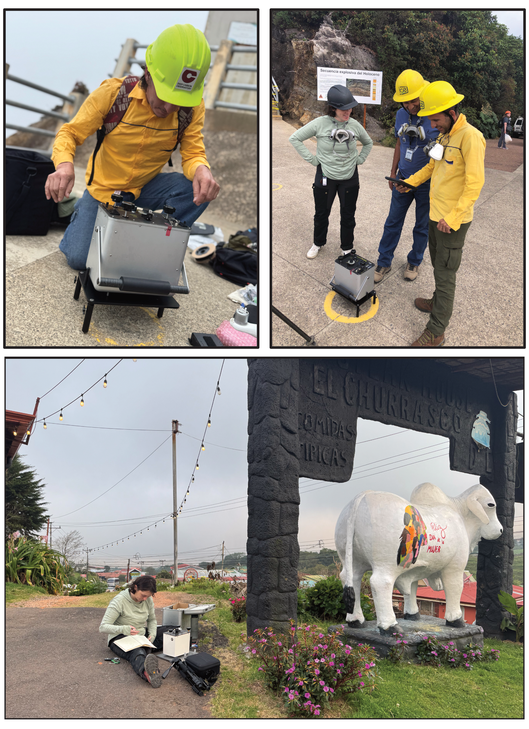
Clockwise from top-left: Badilla setting up the LaCoste and Romberg gravimeter at the Mirador; survey team discussion; Passey making reference measurement at El Churrasco hotel.
Magnetic Surveys and Magnetotellurics. During the initial AVERT installation at Poás (November 2023), 3 permanent, continuous 3-component fluxgate magnetometers were installed: 2 on the crater rim at the AVERT sites VPPC and VPNC, and 1 at VPRS on the north-west flank of the volcano to provide a reference time-series. The objective is to look for signals that can be related to other geophysical observables, e.g., deformation, seismicity, explosive events at the vents. These magnetometers, however, are both temperature sensitive and susceptible to drift through time. Grupo ICE supplied Conor Bacon and Daniel Lee with a GEM GSM-19 Overhauser magnetometer to conduct walking surveys inside the crater area. These surveys were conducted in three parts: firstly, a grid survey of the eastern terrace (an area with active fumaroles and apparent slumping identified from InSAR analysis); secondly, and most importantly, in order to calibrate the continuous time-series data and characterize the magnetic setting of each deployment, 25 x 25 m grid surveys (with 5 m spacings) were conducted at both VPPC and VPNC; and finally, a continuous survey track around the crater rim starting at VPNC, with ~10 m spacing.
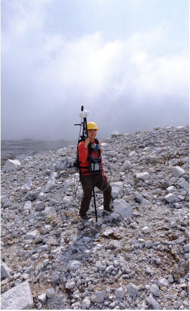
Lee wearing the magnetic surveying rig, with the GSM-19 magnetometer seen as the white block at the top of the staff. Photo: Conor Bacon
In addition to the absolute magnetic field surveys, Grupo ICE deployed a magneto-telluric system on the eastern crater rim, which was left out for 3 days during the workshop. This survey was repeated for another 3 days, and the data were processed by Diego Badilla to look for the presence of conductive layers in the subsurface, down to depths of 5–10 km, which would provide some insight into the shallow magmatic storage system at Poás. The data and results from this survey, and the absolute magnetic field surveys detailed above, may motivate continued measurements of these largely under-explored areas of geophysics.
Station Build-Out and Maintenance. New infrasound sensors provided by AVERT were installed at VPEM, south of the Mirador by the OVSOCORI team. Leo van der Laat led this effort, with Henriette Bakkar, Pierre Boymond and John Bolaños.
Following the small eruption on March 13, Geoffroy Avard of OVSICORI and Terry Plank of LDEO visited VPCR, VPPC, VPNC and the permanent MultiGas site to remove mm-ash coatings on the solar panels and retain the ash samples for future analysis.
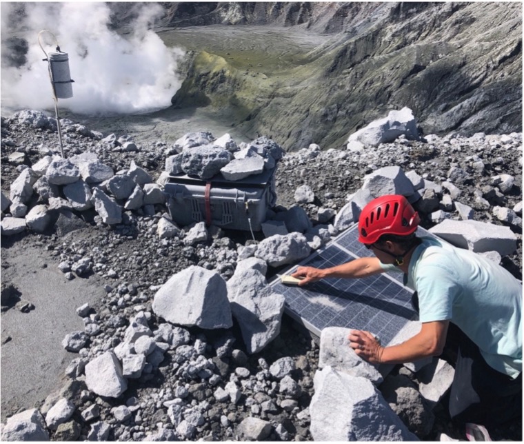
Avard cleaning ash from the solar panels at the MultiGAS site on the western crater rim. Photo: Terry Plank